Findochty Castle
Findochty Castle Details
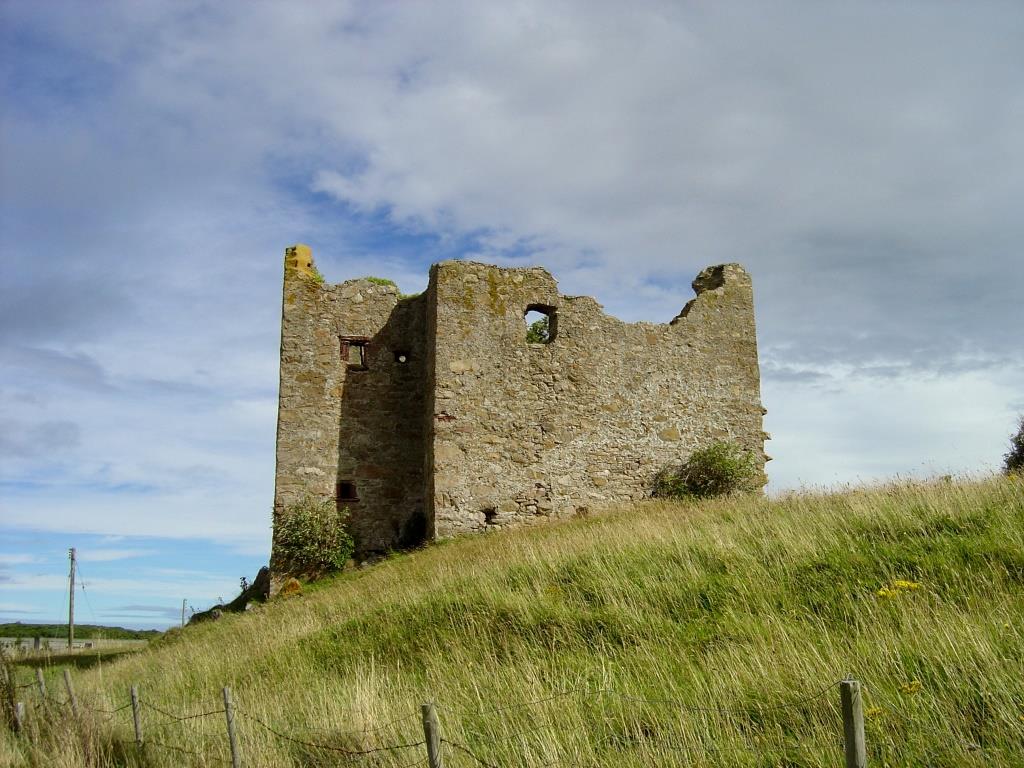
Findochty Castle, ruined C16 tower house of the Gordons/Ogilvies/Ords on mound at the end of a drained loch. Private and fenced off.
- Closest To: Buckie,Findochty,Portknockie,Portgordon,Cullen
- Access: S.O.A.C. Public Access
- Grid Reference: NJ455674
Findochty Castle occupies a spit of high ground in the centre of a large bowl of farmland, which once formed a shallow loch. The site is defensive, but not in a strategically important location. In the 19th century, the castle formed the central block of a much larger building know as the Mains of Findochty. To give an indication of the size, Findochty Castle today measures roughly 10 metres from north to south and about 5 metres east to west. The old Mains extended a total of 50 metres from east to west; roughly twice as far west as the ruined wall you can see from the road, and a similar distance to the west. When this was all demolished sometime in the late 19th century, the old castle walls needed to be repaired, and it was at this point Findochty Castle took up its current appearance.
The earliest reference to the lands of Findochty is in 1440, when the lands of Findochtyfield were granted to John Duff, son of John Duff, by King James II. Later they appear in the hands of various members of the dominant Ogilvie family. In 1547 Queen then took possession of the tack and later the same year Queen Mary gave the tack to her favourite James Ogilvie of Cardell. In 1586, James Ogilvie issued a charter to Thomas Ord in Keithmill, in which the lands of “Findochty with the manor place, port, and customs within the same” are granted to him. Passing through the family, Findochty was sold to the Earl of Findlater in 1724. By 1794 the place was in ruins. Today Findochty Castle is fenced off and is unsafe, but it is possible to walk down the track to get a closer look at the western face of the building.
Become a supporter of my work to access a more detailed history